
Sky Lanes: Forging the Digital Highways for Drone Operations
The push to integrate drones into national airspace is accelerating, with dedicated UAS corridors—or 'sky lanes'—seen as a catalyst for urban innovation. However, the path is fraught with challenges: detect-and-avoid technology, international standards, data sharing, and public trust. Industry leaders and government agencies are collaborating to build the digital and physical infrastructure needed, from LAANC authorizations to multi-million-dollar BVLOS corridors. This article explores the partnerships, pilot projects, and debates shaping the future of drone highways.
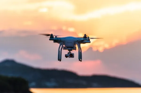
The sky is ripe for innovation as industries and governments look to support growing drone operations with dedicated flight corridors. These unmanned aircraft system (UAS) corridors—conceived as sky lanes—can unlock transformational opportunities for cities. Yet the road to integrated drone operation is fraught with security, regulatory, and public acceptance challenges.
The build-out of aerial transportation networks will require a broad coalition of partners, extending from local and state governments to the Federal Aviation Administration (FAA), NASA, private enterprise, and other stakeholders within the drone ecosystem.
According to Michael Blades, vice president of aerospace, defense and security at Frost & Sullivan, these partnerships face two categories of hurdles: technological and regulatory.
Establishing Standards and Building the Network
Manned aircraft have always operated under the principle of "seeing and avoiding" other aircraft—a capability unmanned aircraft do not yet possess. The FAA is currently working with industry stakeholders to research reliable detect-and-avoid (DAA) technology, which will enable more complex unmanned operations that can be safely integrated with manned traffic.
"There are logistical challenges, especially with the infrastructure that will be necessary to support an aerial fleet of autonomous cargo and passenger carrying drones, after the industry is able to scale production, and gain regulatory approvals, to meet market demand," Blades explained.
He noted several regulatory challenges, both for day-to-day operations and for certifying a UAS as airworthy. Blades emphasized that the development of rules will need to be—or should be—harmonized internationally, so that all approved aircraft can operate globally, akin to how the International Civil Aviation Organization (ICAO) governs global air traffic today.
Among the most critical actors will be UAS Traffic Management (UTM) service providers, which develop APIs to connect drones and drone pilots with digital airspace maps and live navigation services.
One such company is London-based Altitude Angel, whose founder and CEO Richard Parker said the firm’s goal is to create the infrastructure to integrate UAS traffic into the airspace.
"A drone traveling 20 miles is going to fly over infrastructure owned by different parties, it might fly through controlled airspace containing different restrictions and different policies governing them," he said. "As we go forward, that drone operator might need permission from lots of different people, and that can be difficult to sequence—those chains of permission is where we’re helping."
Parker said it is likely stakeholders will start to agree on routes in already established corridors—an approach that is also closely linked to cost. "Building a whole new infrastructure has a very high cost, but an established corridor is a very low-cost proposition," he said.
Another complication is the need for drones to react quickly to vehicles like air ambulances or police helicopters, which can fly at low altitudes—within the same airspace drones would occupy—and land wherever necessary without published flight plans, unlike commercial aviation.
"Assume you get all those bits solved—great apps, great integration, great visibility, costs sorted out—you still don’t have the platform that ties it all together," Parker pointed out. "That platform needs to standardize data from lots of different sources, provide visibility, and provide a navigation service, which can make sense of what is being detected and react to those conditions to keep the drone, and everyone on the ground, safe."
Safety and Data Correlation
The FAA said it is already using UAS test sites to evaluate operations and facilitate routine drone flights in certain areas. Certain line-of-sight operators can use the Low Altitude Authorization and Notification Capability (LAANC) today to request authorization for operations in much of the nation’s low-level controlled airspace near airports.
An FAA spokesperson explained in an emailed statement that the agency is focusing on the drone safety performance it expects, rather than prescribing an exact, detailed design to meet that expectation, as was done in the past.
"Performance-based regulations establish an operational safety and performance level that must be achieved through the aircraft’s design," the spokesperson explained. "This allows continued innovation while meeting overall safety and operational requirements and allows multiple, innovative designs to show they meet the intent of the safety regulation."
The spokesperson clarified that the FAA is focused on integrating UAS into the national airspace system, not on establishing dedicated drone corridors.
NASA is another government stakeholder in this process, explained Sandy Lozito, chief of the aviation systems division at the agency’s Ames Research Center in Mountain View, CA.
"We’re working to enable the urban air mobility market in government and industry, including local government," she said. "Cities have a lot of concern about safety data, privacy issues, noise issues—those are the things they are really paying attention to."
Lozito said one of NASA’s challenges is determining data standards for how to use, acquire, and provide data, but noted that discussions with local governments reveal a high level of interest and enthusiasm for the benefits of advanced drone infrastructure.
“We need to have many of these partners working together and the data be able to be shared,” she said. “One thing we think could be helpful is if someone—NASA or someone else—develops a data standard, so people don’t feel like they have to go out and create their own.”
That position is shared by her colleague Ken Freeman, secure airspace project engineer at NASA Ames, who said local governments are trying to figure out how to work with the FAA to create UAS corridors.
"From an industry perspective, there has to be a business case and a strong potential for profit," he said. "It’s going to be critical the data gets to them when they need it."
The use cases Freeman envisions range from rapid delivery of medical supplies to air taxis that can transport a family of four.
“Anything that takes cars off the road will basically be more efficient,” he said. “Even if it’s just 5%-10%, if we can move that traffic from a 2D to a 3D transportation system, we’ll speed up the vehicles on the ground. It’s going to take a while to get through the public trust, but the technology part is not the hard part anymore.”
Getting the Public Onboard
As Freeman noted, public acceptance will be a critical aspect of any successful drone highway development plan. While mass deployment of drones could revolutionize how we work and live, innovation will be hampered if the public isn’t willing to embrace this new technology.
Issues such as noise and privacy concerns must be addressed publicly, along with ongoing security and safety issues, said Pedro Pacheco, senior research director at Gartner.
"There will be a growing concern from parts of the population in terms of privacy, such as declaring privacy areas and low noise areas, and there will have to be specific goalposts in regards to that, such as not allowing drones to fly at certain hours of the day," he said.
Pacheco pointed to a June 2020 survey conducted by Berlin’s Technical University and nonprofit Wissenschaft im Dialog, which indicated a majority of Germans would oppose the use of air taxis and delivery drones, with an exception for medical usage.
He said it’s a matter of starting to test the technology and perfecting it, finding so-called "corner cases" that account for everything from weather and wind speed to societal perspectives.
"Whenever there is public backlash when a new technology comes to market, it’s important companies behind drone technology are prepared to deal with those situations," he said. "I think we need to wait until trials of delivery drones take place closer to urban centers—that would be the acid test that would generate, at least at first, some polarization and subsequent public debate."
These test cases are gaining momentum in areas as diverse as rural Africa to the West Coast of the United States. In West Africa, UAS logistics company Volansi has been using drones to deliver spare parts and critical components to mining and oil and gas customers, offering a faster delivery solution than alternatives, said co-founder Hannan Parvizian.
"We created different pickup points that merge into a route crossing an airport, and then spread out again," said Parvizian, describing the concept as sky lanes merging into skyways.
Another Volansi project in North Carolina involves delivering temperature-sensitive medicines from a manufacturing facility to a healthcare center across a "fairly densely populated airspace" where the company has established dedicated skylanes.
"It’s not a far distant reality anymore," Parvizian said. "It’s happening now, and I think in a few years you’ll see it explode as the infrastructure and air traffic management becomes more established."
Finding Pioneer Communities
One high-profile step toward establishing drone highways involves the City of Ontario, CA, and Detroit-based startup Airspace Link, a provider of state and local government drone flight authorization and management solutions.
The initiative will explore applications in package delivery and emergency first responder operations, collaborating with the FAA to open up more airspace to support drone flights that use Airspace Link’s technology.
"Ontario is home to one of the leading cargo airports in the U.S., it’s a hub of UPS, a feeder for FedEx, and that makes logistics one of the most important use cases for the services they’re looking to launch," said Lisa Peterson, vice president of business development and marketing at Airspace Link. "What we’re trying to do is work with cities to put in the shared use digital infrastructure, and invite entities to come and launch these services in communities where it’s already set up."
Peterson said the company is also involved in a large-scale, $28 million project in North Dakota to build out a 50-mile, beyond visual line of sight (BVLOS) operational infrastructure that could eventually be scaled across the entire state.
"Once we know the key components of what goes into that recipe, we can normalize those data sets and project that across the whole state, or the whole nation," Peterson explained.
She noted use cases also include emergency service providers, which can use drones to quickly get eyes on the scene, as well as inventory management and aerial surveillance.
Peterson highlighted another potential project linked to the extension of a connected and autonomous vehicle (CAV) test corridor in Michigan to include a drone corridor.
"Michigan is embracing autonomy on the ground, and they’re very motivated to embrace that technology in the air," she said. "It becomes a partnership—we’re bringing together the private sector and the public sector, and we’re the bridge in between."
She noted the company is onboarding about two new agencies per week and has "significant interest" from local and state governments seeking new solutions to safely integrate drones into their communities.
For Volansi’s Parvizian, the case for sophisticated drone infrastructure goes beyond commercially viable use cases to lifting the limits of ground infrastructure and, in turn, improving the environment.
"We’ve destroyed the world around us to enable cars to work, and we spend trillions to maintain these roads, which is a ridiculous amount," he said. "If you spent a trillion on vertical mobility solutions, we’d be so far along in this process."
He predicted that eventually this ground infrastructure will become largely obsolete—or at least banished underground—and surface highways could be replaced with livable green space.
"We want to transform the world, and we imagine a world where you’re not going to establish physical ground infrastructure, you’ll be able to do point to point mobility and logistics, and our life will change as a result of that," he said. "I’m pretty confident that’s where we’ll go in a decade or two—and these are the first steps towards transforming the world as a whole."